CREDO DAT
3
Download
Category: Computer-aided design systems (CAD)
System: Windows XP, Vista, 7, 8.1, 10
Program Status: Free
Looking at the file: 54 482
Description
CREDO DAT is a highly specialized CAD system that allows you to use a large set of tools and functions to automate and analyze information in various branches of science from satellites and ground cameras. This system is an automated tool that allows you to design data and process desktop and geodetic measurements of complex shapes. CREDO DAT is created by developers from Russia and is used in various spheres of life.
Purpose
The program will be useful for drawing up plans of residential buildings and structures of urban infrastructure. The software allows you to prepare cadastral reports, as well as design and create models for reference networks. In addition, this system is used by students who study specialized sciences. The main disadvantage of the software is a high price, which is justified, because the functionality and feature set of the tool is at a professional level.Functionality
This CAD software allows you to import many formats. In the software you process information from Geodimeter, Leica, Sokkia and Nikon loggers. The program allows you to work with different tools, as well as import coordinate data from text files. The software downloads layers in raster format and associated files that are created in other programs of similar purpose. If you need to carry out desktop processing, CREDO DAT allows you to take into account various flaws that occur in the atmosphere or relief. The software shows anomalies, as well as the reduction of directions to an ellipsoid. If necessary, you will calculate the refraction coefficient in the average value and find the main errors that the surveyor has made. This "system" has tools that align and generate geoid models automatically. CREDO DAT saves all models of work in its own format, providing storage of important documents. The graphical environment of the program is created in a convenient shell that provides quick zooming of the entire work area.Key features
- the program has a large set of tools that allows you to analyze geodetic information;
- the software allows you to import documents in different formats;
- the program is suitable for data processing in the industrial field;
- CAD program generates reports, diagrams and plans;
- corrections and anomalies can be "taken into account" in the program shell;
- the program and all help documents are localized into Russian.
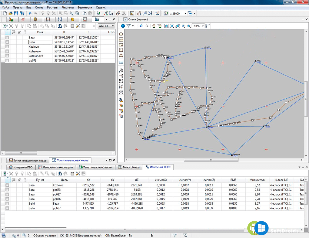
Screenshots
Download CREDO DAT


Comments (0)